

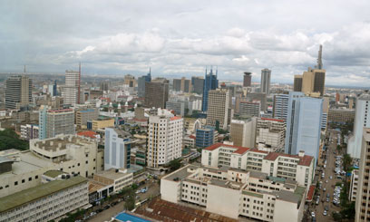


Commuters in Nairobi can now get around easily thanks to a team that has been working on mapping the city’s public transport system. The Digital Matatu team, consisting of a consortium of University of Nairobi’s C4DLab, Columbia University and MIT, has launched ‘The Official Nairobi Matatu Map’ in partnership with Google.
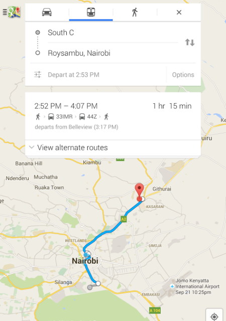
The matatu map, which is now available on Google maps, shows multiple routes, main bus terminals, matatu stages along the way and approximate time taken to transit.
Evans Arabu, Program Manager at Google, explains how Transit mapping aims to organize the world’s public transportation information and make it universally accessible and useful.
“Making sense of the transport structure in Nairobi needs to take cognizance of the culture. For example, most people give directions based on landmarks and buildings compared to roads,” says Arabu.
Nairobi joins 2,800 cities including Lagos and Johannesburg that have a functional transit option.
The mapping of Nairobi’s semi-structured public transport system is, however, a first for Google maps as it will inform the development of Transit maps in similar cities with similar public transport structure like Manila, Dhaka, Mexico City or Dar es Salaam.
The complexity of the public system and lack of reliable and structured data meant the team spent close to one-year collecting and collating the data. Using mobile devices in hand, students working for Digital Matatu traversed the city and as a result, 134 matatu routes and over 3,000 stops in Nairobi County were mapped and a paper map launched in January 2014.
Adding the map to Google’s Transit brings the map an increasing number of smartphones in the hands of nearly half of Nairobi residents.
The data, maps and apps are free and available to the public, transforming the way city residents navigate using public transport. Checking directions from South B to Roysambu, for instance, gives different matatu routes, complete with expected time of departure, walking distance to a bus stop, main terminals, matatu number board, stages along the way and expected time of arrival.