


NAIROBI, Kenya Nov 7 – The Governments of Kenya and the United Republic of Tanzania have commenced the joint boundary reaffirmation exercise of their shared boundary from November 2021 to January 2022.
The purpose of the exercise jointly coordinated by the Kenya International Boundaries Office (KIBO) and the Ministry of Lands, Housing and Human Settlements Development (Tanzania) is to ensure that the boundary is visibly marked on the ground by erecting boundary pillars which mark the limits of the respective territory. These pillars will be constructed using iron rods, binding wire, cement, sand and ballast.
The process of the reaffirmation of the Kenya Tanzania boundary involves the Boundary Maintenance. The reaffirmation process shall commence from Lake Victoria to the Indian Ocean covering a distance of approximately 760 Kilometers. The process will entail re-establishment of destroyed boundary pillars, construction of pillars where none exist and drafting a new agreement to replace the old colonial agreements.

Visible Boundary Line at the Kenya Tanzania boundary.
Also being undertaken during this Joint Reaffirmation Exercise is the collection of geographical names, features and public utilities from a coverage of two kilometers on both sides of the border by the cartographic team. The joint cartographic team will cover the entire expanse of the international boundary by visiting all the villages within all the sub-locations touching the international boundary and interviewing various people to gather information. As a result of this exercise, different names are given to different places within the boundary area, for instance, Sirari/Isebania and Mwishoni/Muhuru Bay are joint community names at the boundary.
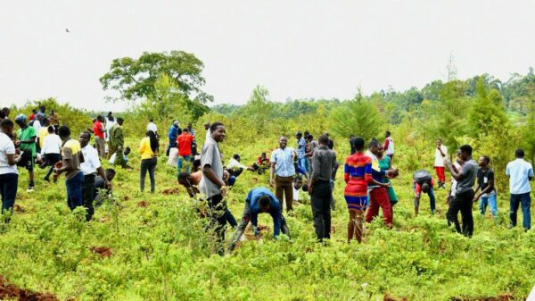
It is important that the local communities are involved in the reaffirmation exercise. The communities are responsible for providing labour for the construction of the pillars and clearance of vista; supplying construction materials for the pillars; taking care of the pillars to ensure that they are not destroyed; and sharing information on the international boundary including the local names of the sites where the pillars are located. The community engagement during the reaffirmation exercise is equal to public participation in the boundary making process. Equally important is the process helps to demystify on the existence of mineral resources beneath the pillars. Majority of all the destroyed pillars stem from the belief that therein contains minerals such as mercury and other. It is for this reason that the local communities are engaged in the construction process as they get to witness first-hand the boundary making process. Also important is this community is charged with the responsibility of protecting and maintain the pillars for eternity.

Kenya and Tanzania surveyors prepare the site for the construction of a new Boundary Pillar BP18/1/I at the Maasai Mara National Park/ Serengeti National Park last week.
The reaffirmation exercise will create a boundary that will enhance security and protection of citizens; facilitate the management of transboundary resources; and unite communities and ensure peaceful co-existence.
During a Joint Technical Committee meeting held two weeks ago at the Namanga One Stop Border Control Point and involving surveyors from the two countries, the meeting agreed to divide the reaffirmation exercise into six different phases. These phases extend from Boundary Pillar (BP) Mwishoni (Lake Victoria) to the Mara River covering 118km; from Mara River to Lake Natron covering 120 km; from Lake Natron to Namanga covering 110km; from Namanga to Oloitoktok/ Tarakea covering 110km; from Loitoktok/ Tarakea to Lake Jipe and land boundary Ruvu Pangani covering 100km; from Lake Jipe to Karuma Hills covering 90km; and from Karuma Hills to Vanga covering 110km.
The expected outcome of the reaffirmation exercise will be a clear boundary line consisting of a vista (Clear zone to enable boundary visibility) and, a boundary agreement between the two neighbouring countries. The clear boundary line will have boundary pillars constructed at a distance of 250 meters and 500 meters at different sections. These pillars will be painted white for visibility purposes. The pillars within the Maasai Mara and Serengeti National Parks will not be painted but rather retained in natural colours to blend with the environment.
Considering that the boundary traverses the Maasai Mara and Serengeti National parks, the joint teams undertaking the reaffirmation exercise must contend with hordes of marauding buffaloes, elephants, lions, extreme harsh weather conditions such as hail storms, poor road network to access some of the sites and complete absence of communication especially within the different national parks, and water bodies; challenges all which delay the entire process.

Lions play at the Boundary pillar at the Maasai Mara/ Serengeti National Park.